
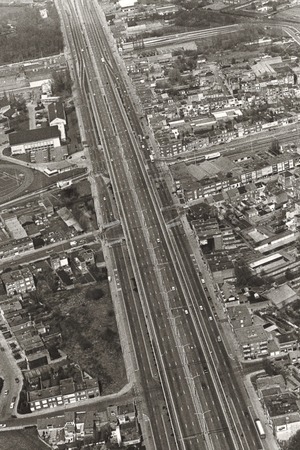
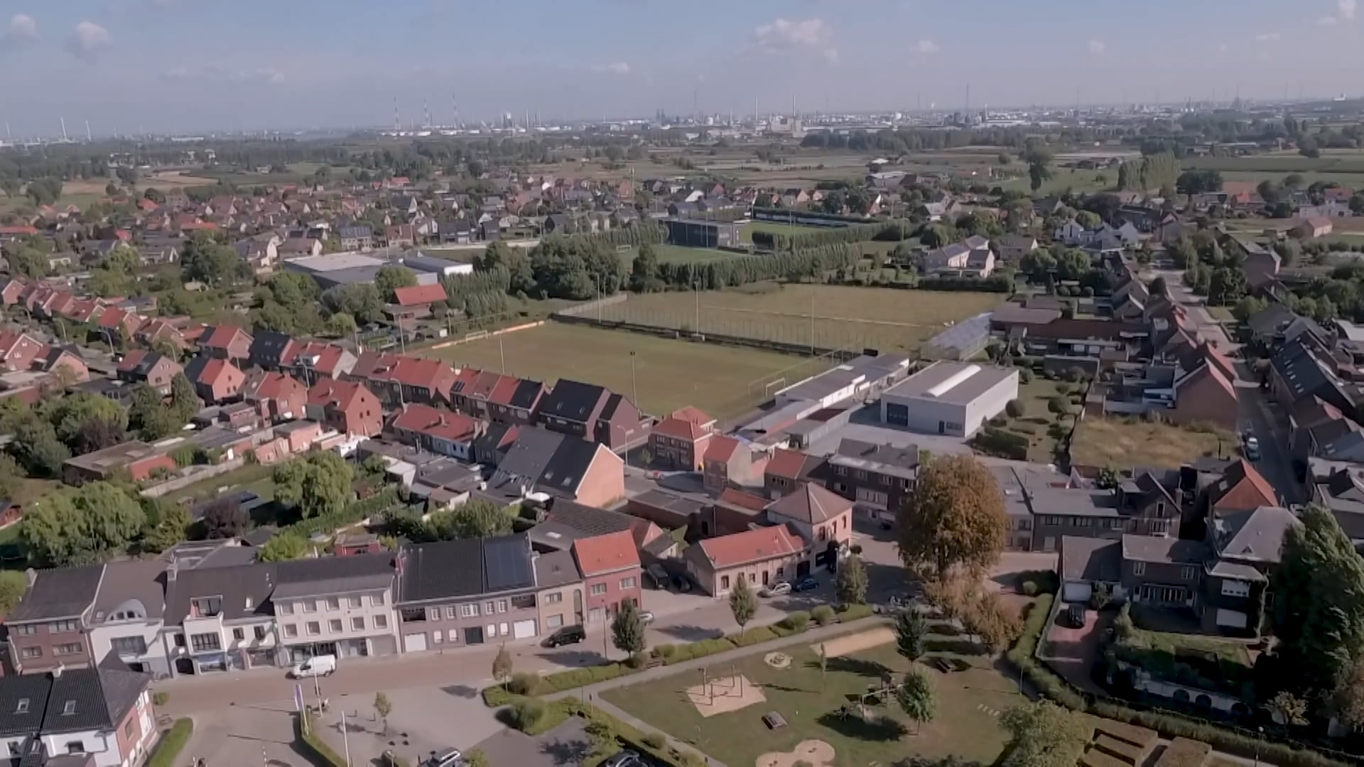
Aerial photograph of Heist-op-den-Berg. The ribbon development is visible on the panorama, 1958 | Kempenserfgoed.be, collectie Gaston Van den Broeck, photo GAH008000001


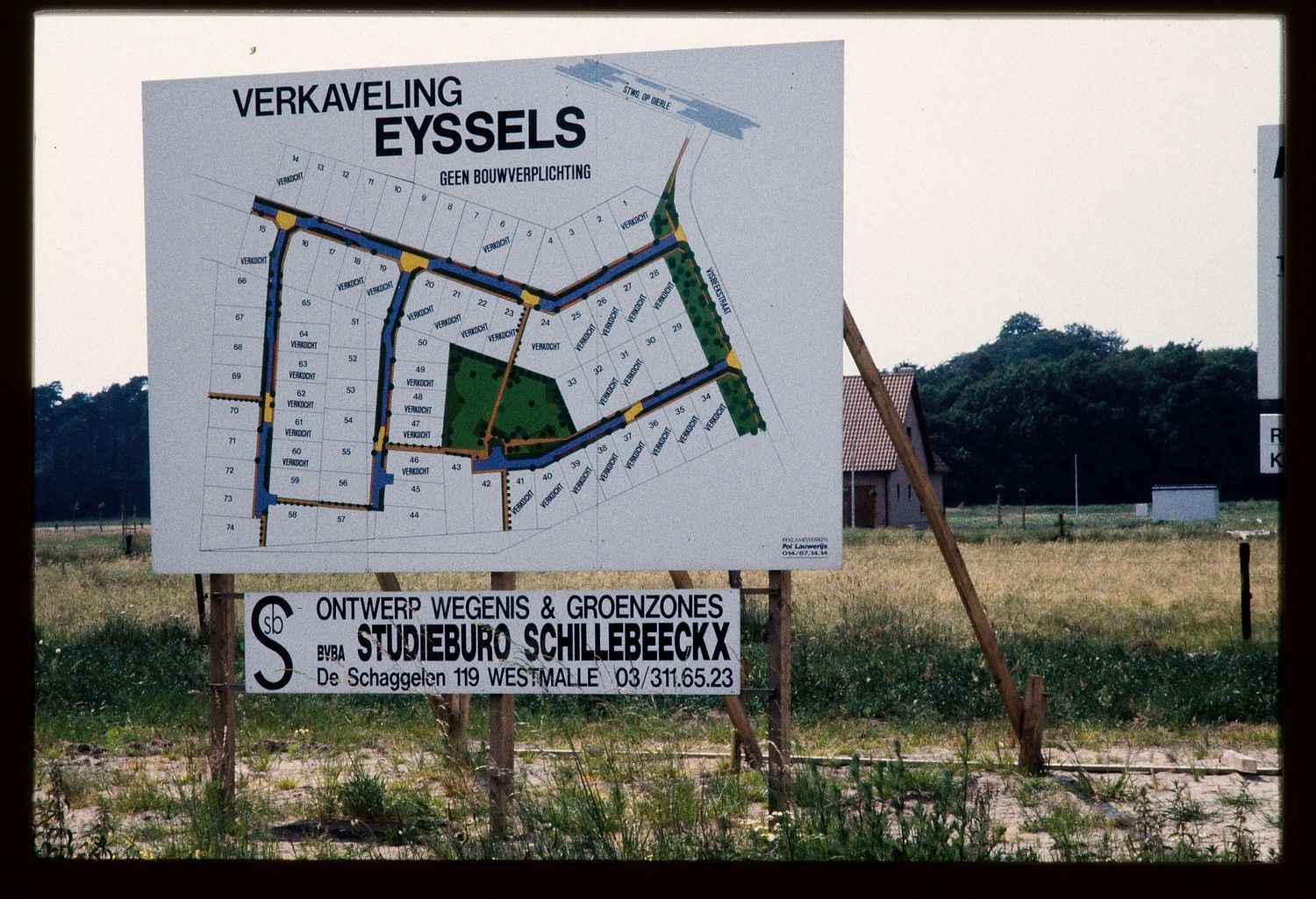
Ribbon Development
Spatial Planning in Flanders
Cobbled roads that wind from village centre to village centre, flanked on either side by villas, businesses, here and there a meadow and especially lots of improvised buildings: that view has been typical for decades of densely populated Flanders.
Almost a quarter of Flemish homes, but also many outlet stores are sited on connecting roads between municipalities. When added together those roads form a strand of 13,177 kilometres – more than the distance from Brussels to Singapore. Because of that ribbon development one built-up area merges almost unnoticed into the next.
Maps from the 18th century already show traces of ribbon development in the Austrian Netherlands. The flat landscape was well-suited to the building of homes and roads. But the real phenomenon dates mainly from after the Second World War. The government gave citizens and companies a great deal of freedom to build where they wanted. With the advent of the car the working Fleming was no longer forced to live close to a centre. Rural Flanders was divided up into one great residential zone.
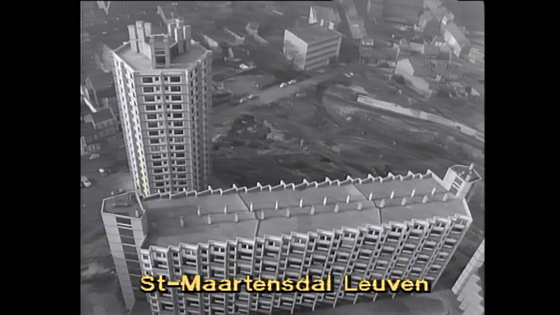
Leuven, KADOC-KU Leuven. kfa015338
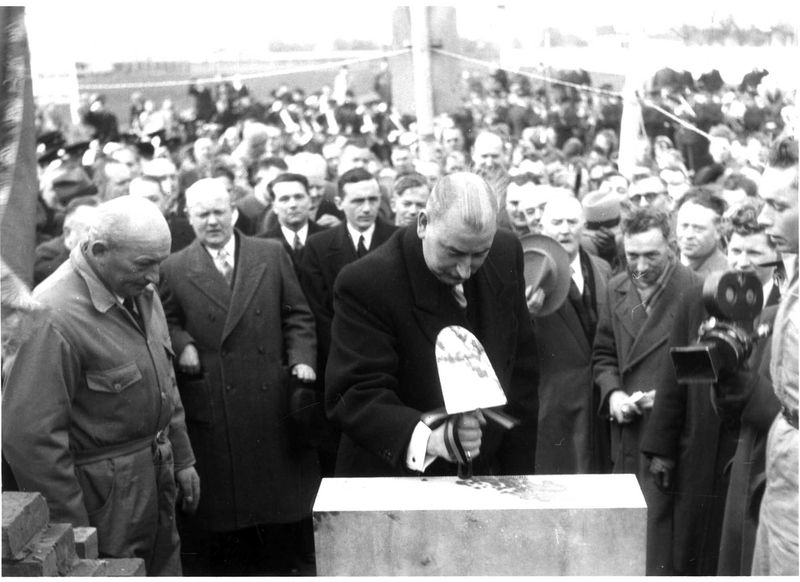
Minister of Health and the Family Alfred De Taeye (1905-1958) in Waregem (Province West-Flanders) at a laying of the first stone ceremony for the hundred thousandth economical home in 1954.
Spatial Planning in Flanders
The fragmentation of open space has early roots, but in the late 19th century it became a conscious aim. Administrators did not want too many workers to move into towns, for fear of social unrest. So they supported commuting and encouraged individual home ownership.
The housing shortage after the Second World War played even more into the hands of ribbon development and fragmentation of Flanders. At that time the government wanted to provide everyone with a good home. That was an important constituent of the welfare state. The Christian-Democratic party insisted on a house of its own for every family, preferably out of town. A law of 1948, named after its initiator, Alfred De Taeye, provided building subsidies and cheap loans.
The one-family homes mushroomed. There was as yet no spatial planning. Not until 1962 was the first law on spatial planning passed and later came regional plans which demarcated zones for housing, agriculture and industry. However, towns and municipalities seldom refused building permission and welcomed smaller plots. Moreover, from the 1990s onwards many shops moved to the connecting roads. The environment and mobility were the great victims of that evolution. The tailbacks particularly increased greatly. In 2022 they averaged on every working day 679 kilometres.
Focal points
Lier, Stadsarchief, SLI001020698
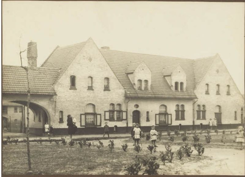
The garden suburb Zuid-Australië in Lier, built in 1920. The suburb was almost completely destroyed by German bombardments during the Second World War.
The Garden Suburbs, Surrounded by Green
Ribbon development and fragmentation were not inevitable. In the past there were experiments with an alternative, more planned approach. Between the two World Wars, for example, so-called ‘garden suburbs’ were built, mainly in Flanders and Brussels. These were districts with comfortable family homes in the same style, surrounded by a common green space. The concept came from Great Britain. As new ‘villages’ on the edge of town the garden suburbs offered a healthy and affordable alternative to the overpopulated and unhealthy workers districts in the centre.
The popularity of the garden suburb was a result of the devastation of the First World War. In West-Flanders particularly villages and towns had been razed to the ground, and thousands of families were homeless. An urgent priority was to build new homes. The town planner Raphaël Verwilghen was one of the principal promotors of the garden suburb. Modern garden suburbs like Batavia in Roeselare and Ons Dorp in Menen became the showcases of reconstruction. They were often constructed by one of the many social housing companies which emerged in those years.
In the Limburg mining municipalities the garden suburbs remained popular for a long time for workers’ housing. In addition, in 1935 the National Company for Small Land Ownership was set up, which built and sold districts with social housing. In that way it also propagated the garden suburb idea in Flanders. True, that happened mainly at the planning and architectural level. The community ideal on which the first postwar garden suburbs were based, was soon lost sight of.
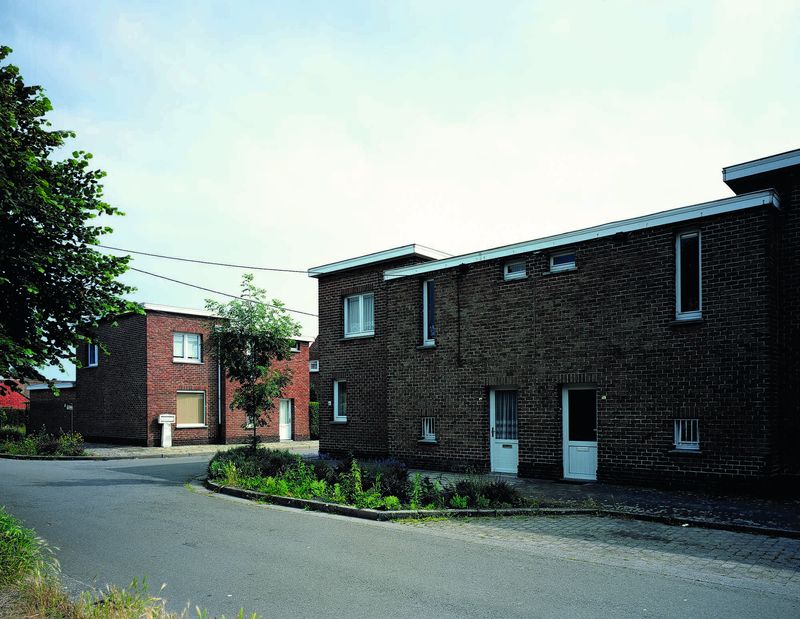
Brussels, Vlaams Agentschap Onroerend Erfgoed
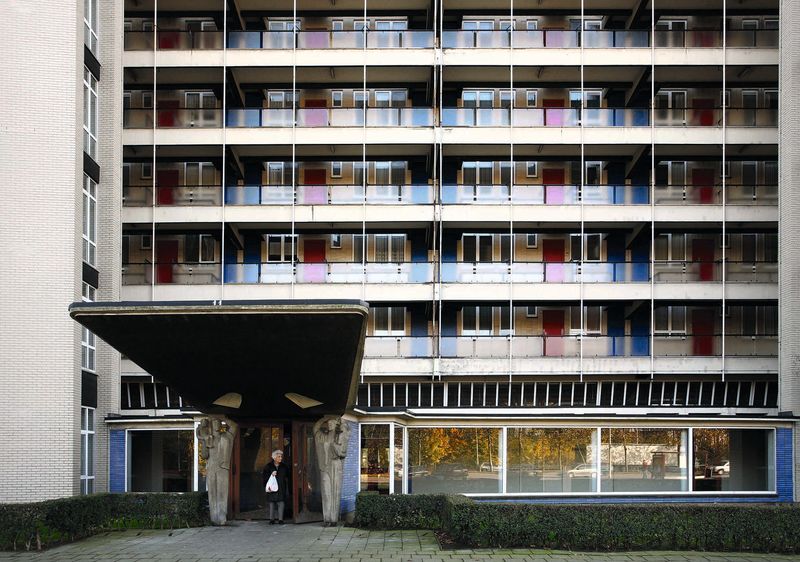
One of the colourful living blocks by Renaat Braem (1910-2001) on the Kiel in Antwerp, 2007.
The Braem Blocks: Social Housing
After the Second World War too there were experiments in Flanders with new living zones. In the 1950s Kiel in Antwerp changed its look. The district gained an extra eight hundred social rental apartments, spread over nine concrete living blocks. The constructions of Renaat Braem were intended to stimulate a community feeling among the residents. They were colourful, airy and full of light. The living blocks rested on great pillars, so that you could walk underneath them. The earth belongs to everyone, was the underlying thought.
Braem was able to design the new district thanks to the Antwerp mayor Lode Craeybeckx, who was very committed to social housing and building high. In this way Braem and Craeybeckx put the housing vision of many Belgian Socialists into practice. In order to solve the postwar housing shortage, the government must itself build affordable social rental homes in and around the towns.
Braem was inspired by his old internship mentor and pioneer of modern architecture, the French-Swiss architect Le Corbusier. The Kiel ‘blocks’ were known worldwide as models of modern urban architecture. The architect later built other social housing districts, like the towers of the Sint-Maartensdal in Leuven. Yet such large social housing projects remained limited in Flanders. Buying one’s own house or building or modifying it to one’s own taste remained most people’s dream. That’s why it is often said of Flemings that they have ‘a brick in their belly’.
Discover more on this topic
Terzake Renaat Braem
Bron: VRT archief – 1 okt 2010
Terzake
Bron: VRT archief, KADOC – 1 sept 2016
Journaal
Bron: VRT archief – 12 nov 2018
De Jaren 60 – Bouwwoede
Bron: VRT archief – 15 mei 1988
Non-fiction
Wonen in Welvaart. Woningbouw en wooncultuur in Vlaanderen, 1948-1973.
Vlaams Architectuurinstituut, 2006.
Het lelijkste land ter wereld
Davidsfonds 1968.
Het schoonste land ter wereld
Kritak, 1987.
Ugly Belgian Houses. Don’t try this at home
Borgerhoff & Lamberigts, 2015.
More Ugly Belgian Houses. Don’t try this at home
Borgerhoff & Lamberigts, 2021.
De golden Sixties: hoe het dagelijks leven in België veranderde tussen 1958-1973
Manteau, 2022.
Hoe zouden we graag wonen? Woonvertogen in Vlaanderen tijdens de jaren zestig en zeventig
Universitaire Pers Leuven, 2012.
Met voorbedachten rade. De sluipmoord op de open ruimte
Kritak, 2022.
Het Vlaamse platteland in de fifties
Davidsfonds Uitgeverij, 2012.
Wonen in Welvaart. Woningbouw en wooncultuur in Vlaanderen, 1948-1973
VAi, 2006.
Onder de kerktoren. Waarom Vlaamse dorpen toekomst hebben
Davidsfonds Uitgeverij, 2021.
Fiction
De voorstad groeit
Manteau, 1943.
Suske en Wiske, De Beestige Brug (nr. 343)
De Standaard, 2015.